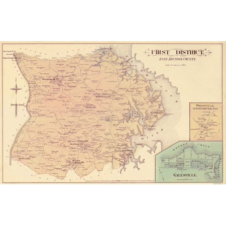
Old County Map - Anne Arundel, First District Maryland 1878 - This is an exquisite full-color Reproduction printed on high-quality gloss paper, art paper or canvas.
Print Size: 23.00 x 36.27 inches
Sites and Townships Specific To This Map Are: Up Close inserts of Owensville West River Co. and Galesville Featured. Also Included are Patuxent River, South River, West River, Mt. Pleasant, Mt. Zion, South River P.O., West River P.O., Davidson P.O., Rutland P.O., Governers Bridge, and Landowners such as Henry Carr, E. Vernon Compton, Wm. Shepperd, Jacob Brid, E.H. Burwell, Beale Worthington and several others also included.
The following towns are featured: Davidsonville, Birdsville, Scrabbletown, Owensville, and Galesville.
This Map is Situated in: Anne Arundel County, Maryland
SKU: MDAN0003
Original Maps are often difficult to find and usually have fold lines, identifying stamps or markings, tears, ragged edges, and assorted other natural signs of age that detract from their beauty. All of our maps have been professionally restored to depict their original beauty, while keeping all historical data intact.
These maps are fabulous pieces of history full of information useful to Historians, Genealogists, Cartographers, Relic Hunters, & Others. They make fascinating conversation pieces and splendid works of art for the home or office.
Shipping: Your artwork is rolled for shipping

| Features | Giclee Printing |
| Brand | Maps of the Past |
| Color | White |
| Home Decor Style | Vintage |
| Theme | Historic Maps |
0 comments:
Post a Comment